GIS Portfolio
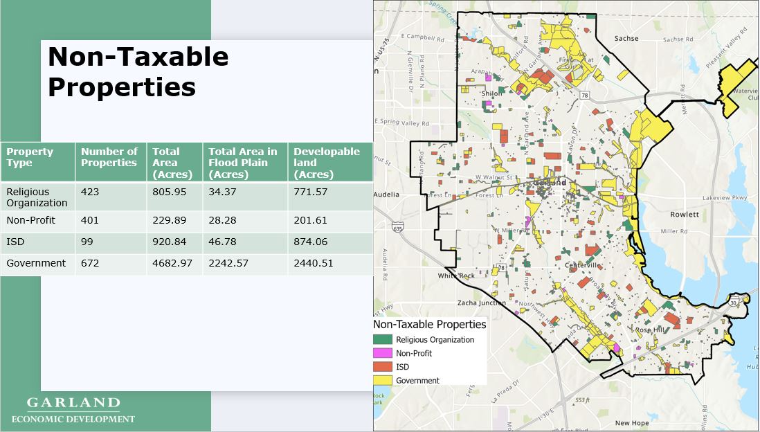
Non-Taxable Properties - Garland, TX
The following map displays the spatial distribution of non-taxable properties in the City of Garland, TX. The director of the Economic Development Department wanted to know the number of properties and total acres of non-taxable land in Garland. The director also wanted the total number of developable acres (non-flood plane) of non-taxable properties. This analysis required an overlay of a flood plane layer and creating new fields to calculate developable acres. This analysis revealed that there are 1,595 non-taxable properties. These properties amount to 4,286 acres of developable land. This analysis will assist the Economic Development Department to identify properties that could be suitable for redevelopment.
Data: Dallas County Appraisal District
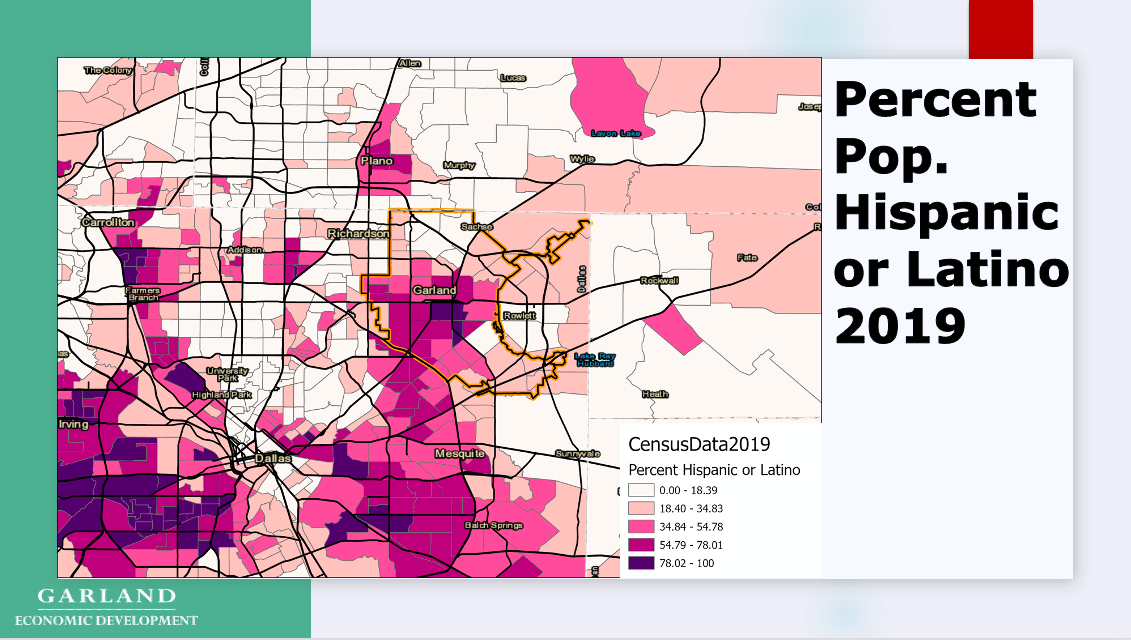
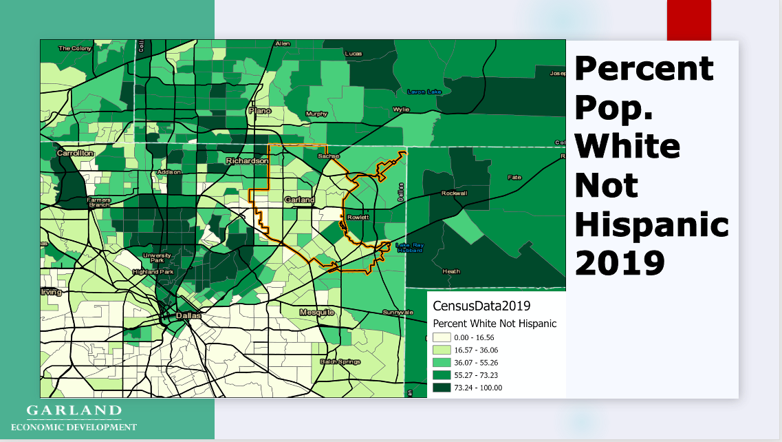
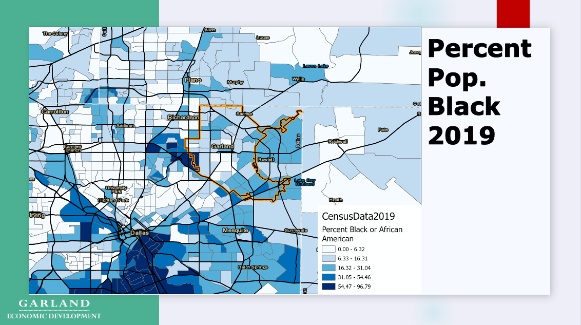
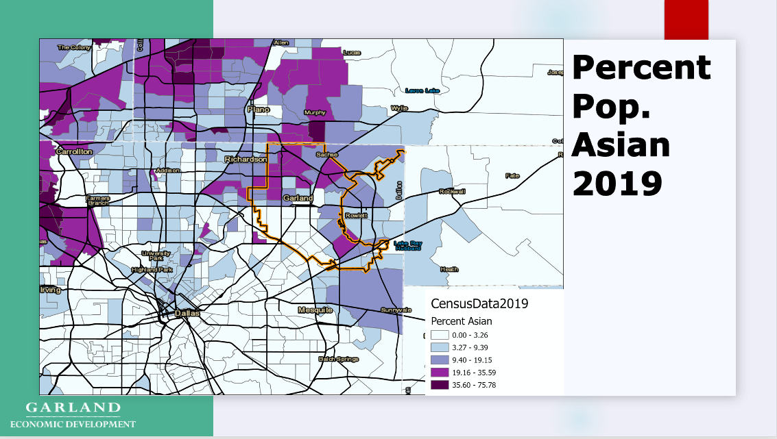
Race/Ethnicity Across North Texas (Garland, TX highlighted)
Data: American Community Survey 5-Year Tract Level Estimates (US Census)
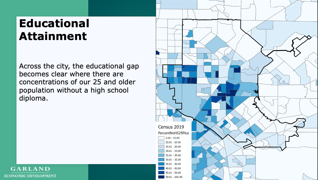
Education Gap - Garland, TX
Data: American Community Survey 5-Year Block Group Level Estimates (US Census)
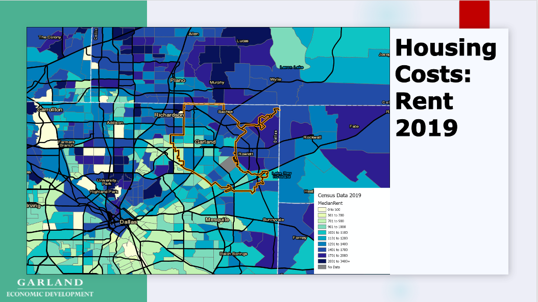
Rental Housing Costs - Garland, TX
Data: American Community Survey 5-Year Tract Level Estimates (US Census)
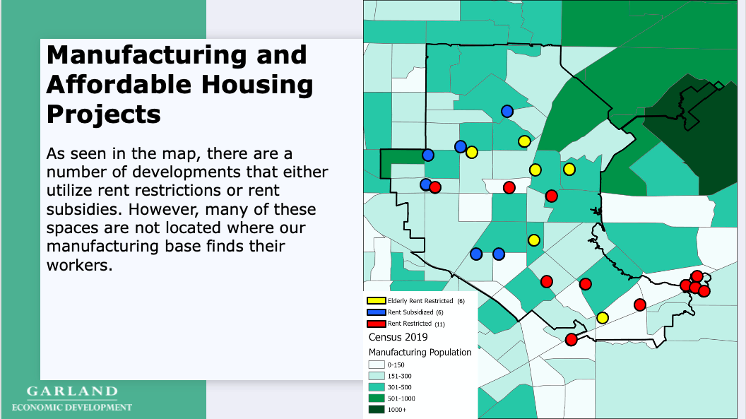
Manufacturing Labor Force & Affordable Housing - Garland, TX
Data: American Community Survey 5-Year Tract Level Estimates (US Census)
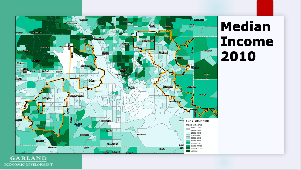
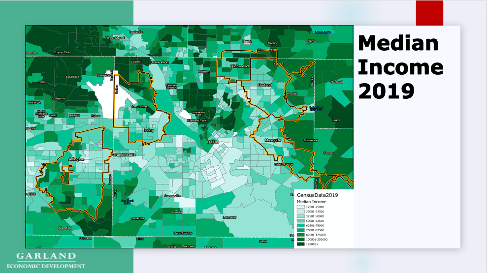
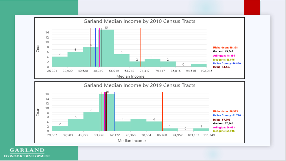
Median Income - 2010 to 2019 Cities Comparable to Garland, TX
Data: American Community Survey 5-Year Tract Level Estimates (US Census)